The Short Ways: The Old Jones Road Trail
Twenty Years on the Blue Ridge Parkway
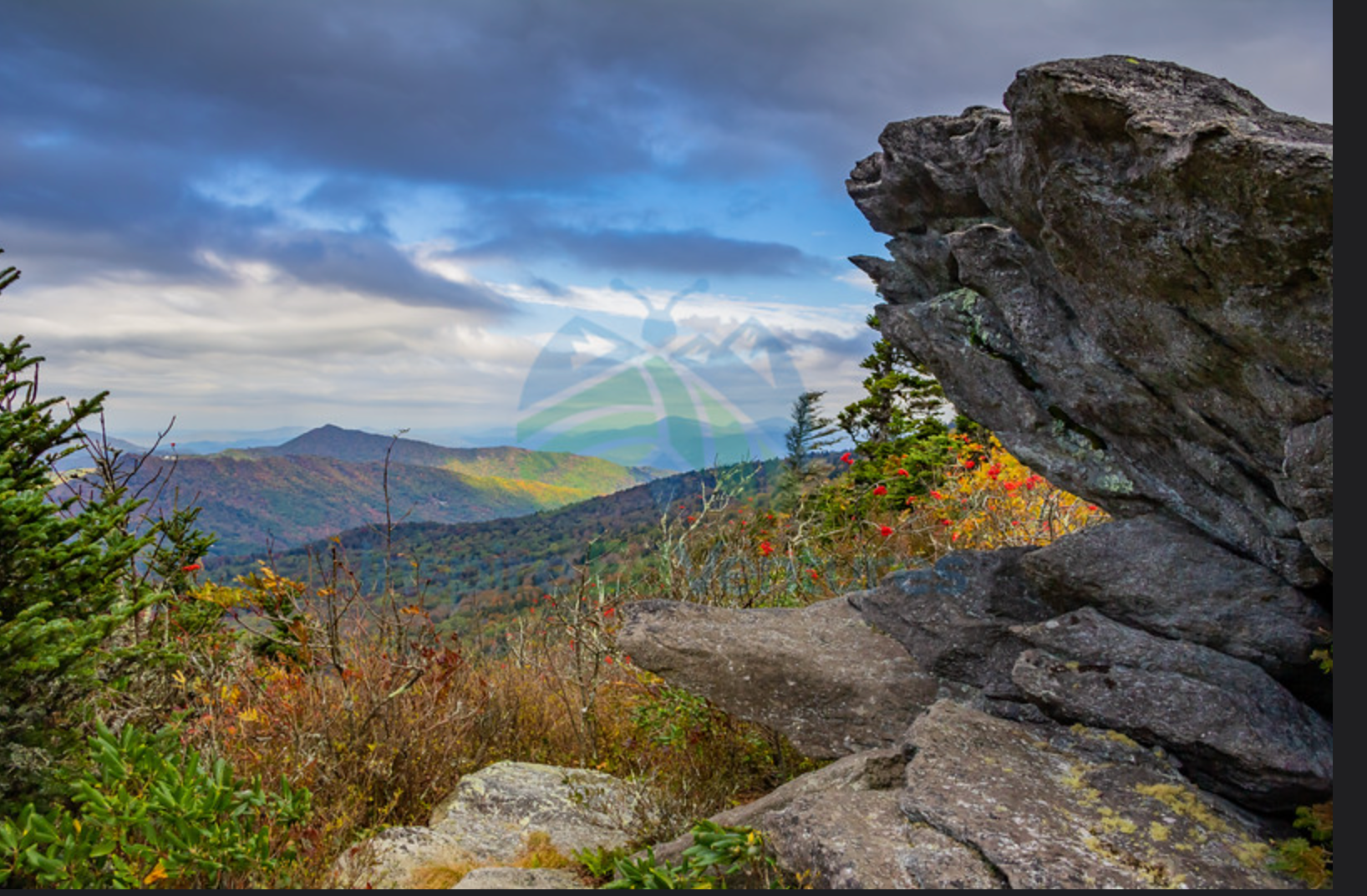
I’m lucky enough to live in one of the most beautiful places on the Earth for hiking - the area of the Blue Ridge Parkway around Boone and Blowing Rock NC. Years ago, when I was looking for my next teaching position, we came to this area to interview for a job at Appalachian State University, which at that time, was a just a small regional university in the mountains of NW North Carolina.
After our interview, we took our two young children for a drive along the Blue Ridge. The area just wotuh of Blowing Rock has some of the most spectacular scenery to be found anywhere. Our decision was made.
More than 20 years later, my son (who was not even 4 when we moved here) and I started this website about hiking. Here, in the Short Ways part of our website, I want to introduce you to some of the shorter, but definitely not less inspirational, trails that I hike, as often as possible, to think, enjoy nature, and forget about the world around me.
There is no significance to the order of these stories - they are just stories from the trail, recorded and presented when they inspire me. I hope you enjoy them as much as I have.
Looking for some amazing photos of the Blue Ridge? Visit our online store! (Proceeds benefit conservation efforts!)
The Old Jones Road Trail
There are lots of amazing trails along the Parkway. In the summer, and especially the fall, many of these are very busy places. I don’t enjoy crowded trails, so I want to introduce you some of the lesser-known paths that I’ve discovered over time. As a hiker, all of these represent unique moments in time in my life, and all have fun stories to remember.
To start, we will begin with one that I have been hiking for a while - the Old Jones Road Trail.
The Old Jones Road Trail doesn’t show up on many maps. Even my AllTrails app doesn’t recognize it by name. But if you are heading south on the Blue Ridge, at around mile marker 295.5, you will come across the Sims Creek Pond Overlook. I’ll talk more about the Sims Creek Trail in future posts, since it is also a favorite of mine and one that played an important role in my preparation for the Long Ways hikes that are the focus of our site. If you want to explore the Old Jones Road Road Trail, this is usually a decent place to park since the trailhead (just a few hundred yards south along the Parkway), only has a few parking spaces for cars along the road.
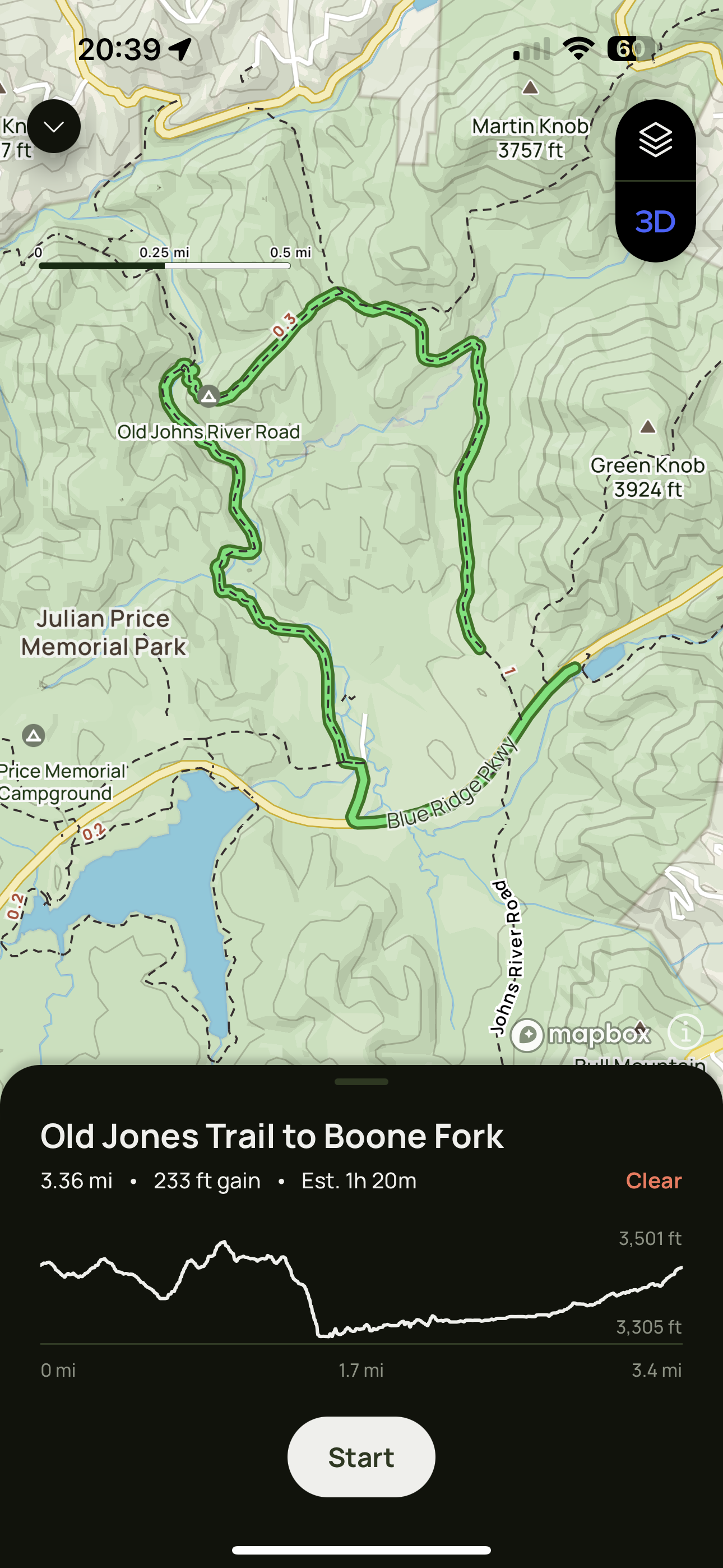
Hiking the Trail from the Parkway to the Boone Fork Trail
A short walk southbound along the Blue Ridge, passing the turnoff on the right to the Sims Creek trail, will lead you to the start of this hike. There are no trail signs nearby, just a small parking area on the right and a gate to lead you onto the trail. This is a very easy section of the hike, and just a short ways up the trail you will find a small meadow and natural butterfly garden!
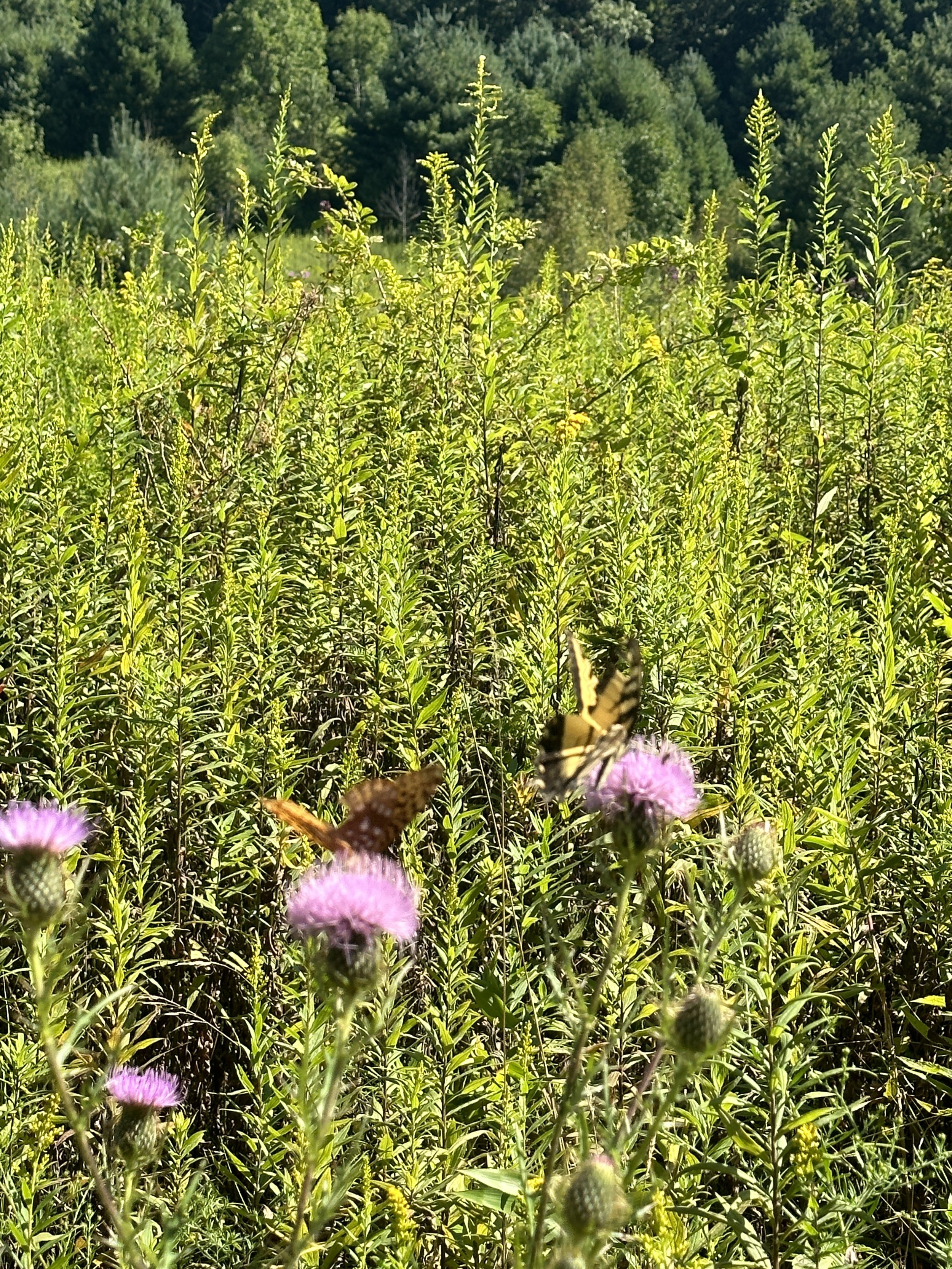
Throughout the spring and summer there are several places along the trail that host a variety of butterflies.
From here you will head onto a wooded and easy to follow path until you reach an the area of an old beaver pond. Years ago, when my kids and I hiked this path, the beaver dam was definately an obstacle. Those aquatic engineers have long moved on from this location, but you can still see the influence of their handiwork here - open spaces for birds and lots of room for flowering plants and their insect friends.

The old beaver dam area on the trail… now pretty easy to cross.
From here the trail will start a slow climb, and eventually link up with the Mountains to Sea Trail (MST) about 1.2 miles in. This is one of my favorite sections along the train, and in the fall, it’s absolutely beautiful. But here’s a warning .. if you are traveling with small children, the trail will become a little more moderate as you approach the area around Boone Fork Creek. There are several rock scrambles, none of them very long, that can be very slippery in wet weather. All along this trail you will encounter areas of rhododendrons - no trail along the Blue Ridge is without them! They often form complete canopies over you, which can be a respite for a brief rain shower, but in the heat of a mountain summer, can create a humidity nightmare. So, don’t forget your water!
Around 1.5 miles in you will pass a small campsite, and then begin your descent down to Boone Fork Creek. Portions of this descent are moderate, but even those secctions are no more than a few dozen meters.
At the bottom, you will arrive at one of my favorite places - Boone Fork Creek.

The bridge connecting the Old Johns Road Trail to the Boone Fork Creek Trail.
From here you have some decisions to make. If you parked at the Sims Creek Pond Overlook, the easiest way to get back is to spend some time by the water and then retrace your steps. If you are feeling a little more adventurous, you can cross the bridge and link up with the Boone Fork Trail.
If you decide to cross the bridge, the trail to the left will take you back to the Julian Price picnic area in about one mile. If you head to the right along Boone Fork, you will venture onto another of my favorite hikes that will take you to the falls along the Boone Fork Trail. Eventually, after another 4.5 miles, you will end up at the same picnic area. The only issue with these two choices is that in order to get back to the parking location at Sims Creek, you will need to walk north along the Blue Ridge for about a quatrer of a mile. Just a warning, the sides of the road are not developed, and the traffic along the Parkway can be intense in peak seasons. So if this it not your thing, definitely turn around at the end of the Old Jones Road Trail!